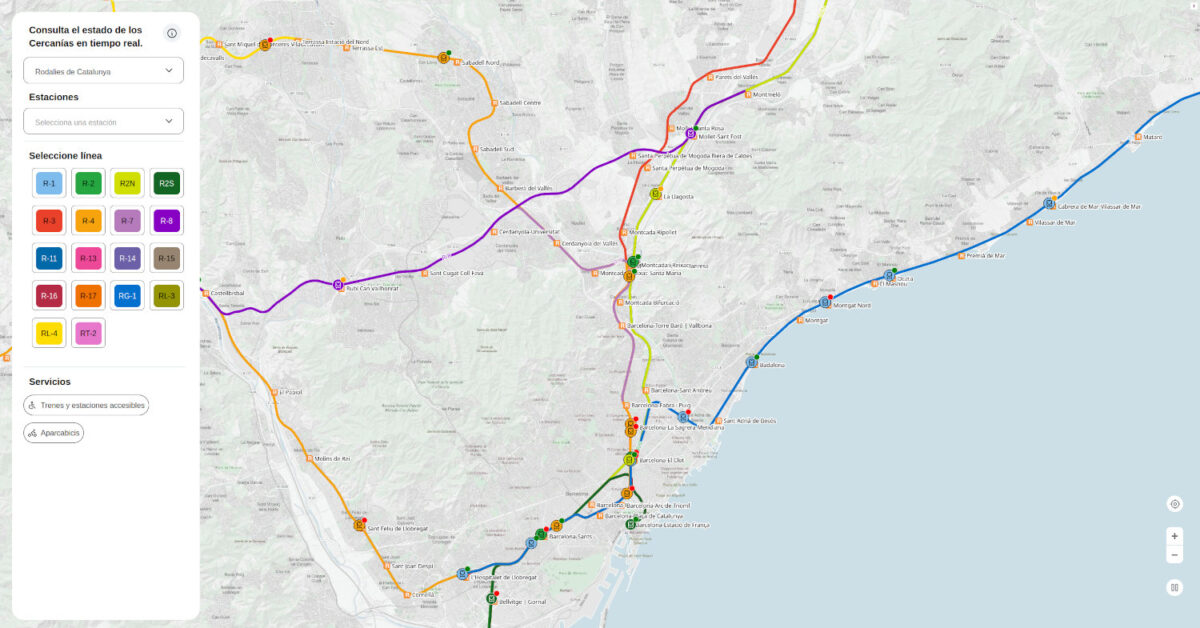
Spanish public operator Renfe continues to improve its transparency policy. After having made the raw data public a few months ago, today it has released an interactive map that shows the position of all suburban and Rodalies trains in real time.
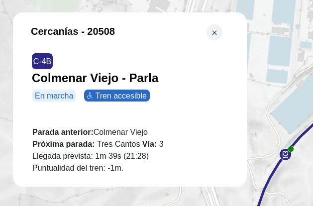
The map covers the whole of Spain, although it allows you to filter by hub and line and to focus on each station from a menu. By clicking on each train, you can see its number, line, next stop with its estimated time of arrival and punctuality.
In addition, the map shows whether stations are accessible or have bicycle parking facilities.
¿Hasta el pantógrafo de tanto anuncio?
Trenvista Premium te lleva directo, sin anuncios que hagan descarrilar tu lectura ni tu paciencia.
Únete por sólo 35€ al año, disfruta de contenidos exclusivos, más ventajas y cancela cuando quieras.
★ Empieza ahora
Trenvista Premium te lleva directo, sin anuncios que hagan descarrilar tu lectura ni tu paciencia.
Únete por sólo 35€ al año, disfruta de contenidos exclusivos, más ventajas y cancela cuando quieras.
★ Empieza ahora
To see it, go to https://tiempo-real.renfe.com/